Remote Earthwork Takeoff Support in the USA
Updated: Oct 8
Ring Geospatial offers remote earthwork takeoff, cut-and-fill analysis and modelling support for estimating firms, surveyors and civil contractors across the USA. If a tender is approaching or your team needs extra capacity, we can agree a defined package using your survey and design information.
A personal connection
My interest in the USA goes beyond earthworks. In 2023, I drove more than 3,000 miles through Las Vegas, Death Valley, Los Angeles, Yosemite and San Francisco, exploring national parks along the way.

Yosemite was my favourite. The landscapes were extraordinary, but I loved the whole experience: the food, the country music and the scale of the infrastructure. I came home joking that I had driven 3,000 miles without finding a pothole — quite a change from some of my journeys in the UK!
What the remote support looks like
Using Civil 3D and AGTEK, we prepare agreed earthwork quantities, models and review drawings. The aim is to give your team something it can check, with the input revisions, measured surfaces, assumptions and exclusions made clear.
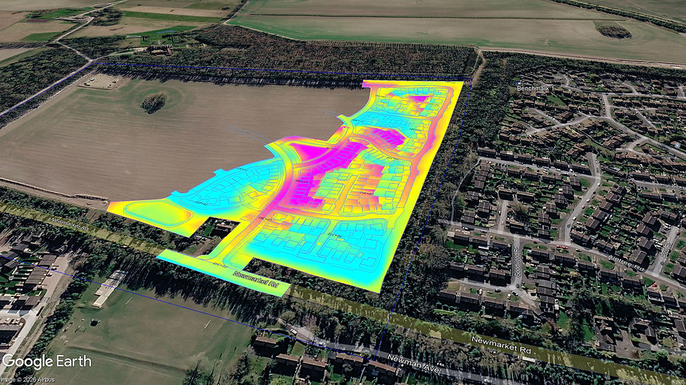
The image above is a UK project at Royston, Hertfordshire, included to show the type of model we produce. The scope, units and deliverables for a US project are agreed with your team.
Agree the US project details first
Project coordinate system, vertical datum and measurement units.
Quantity units, including whether volumes are required in cubic yards or cubic metres.
Measured surfaces and the basis for stripping, unsuitable material, bulking or shrinkage.
File formats, review milestones and handover times around your team's time zone.
What to send
Share the existing-ground survey, proposed design drawings or surfaces, relevant earthworks specification and deadline. Include the project location and the outputs your estimating or construction team needs. We will identify missing inputs and confirm the scope before modelling starts.
Support can cover a complete earthworks package or a defined part of the work. For subcontract support, your team retains the client relationship.

Comments