Earthworks Take-Offs: A Practical Tender Guide
Updated: Oct 8
An earthworks take-off measures the material to be excavated, placed or removed. A useful take-off gives your estimating team a quantity it can trace back to the drawings, surfaces and assumptions behind it.
Start with the right information
Gather the existing ground survey, proposed levels, site boundaries, current drawing revisions and earthworks specification. Confirm the coordinate system, vertical datum and units before comparing surfaces. Missing breaklines or unclear boundaries can change the volume even when a model looks plausible.
Measure the construction surfaces
Existing ground compared with finished design level does not always give the quantity needed for construction. Topsoil stripping, pavement build-ups, foundations and formation allowances may need separate surfaces and quantities. State which layers are included and check that the same excavation has not been counted twice.
A real example: Royston, Hertfordshire
This Ring Geospatial earthworks model is from a Hertfordshire development with an approximate 20 m level difference and a complex retaining wall strategy. Splitting the site into work areas helps the team review where the quantities occur, alongside the proposed levels and retaining features.
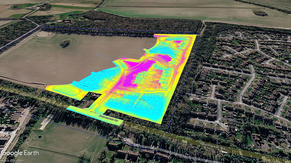
An isopach drawing shows the level difference between two defined surfaces. Read its colour bands against the drawing legend, then use the quantity schedule to understand the measured cut and fill. An aerial visual alone is not the quantity report.
Keep geometry and material assumptions clear
Report cut and fill separately, preferably by plot, road, pond or agreed work area. Distinguish in-situ excavation from loose material and compacted fill. Bulking, shrinkage, suitability and reuse assumptions should come from the project team or relevant investigation, with their basis recorded.
What a useful take-off should include
A schedule of cut, fill and other agreed quantities by work area.
Drawings or model views that identify the measured boundaries and surfaces.
The survey and design revisions used, plus units and material states.
A short assumptions and exclusions register, with unresolved queries highlighted.
For a revised road formation, for example, compare the updated model with the recorded baseline and identify the affected work areas. That gives the estimator a clearer explanation of the quantity change than a replacement site total on its own.
Before your next tender
If your team needs extra capacity, send the survey, current design information, required outputs and tender deadline. Ring Geospatial uses Civil 3D and AGTEK to support complete take-offs or defined packages for estimating firms, surveyors, modelling businesses and civil contractors.

Comments